August 2026 · Feature
Site plans: draw the job on the property
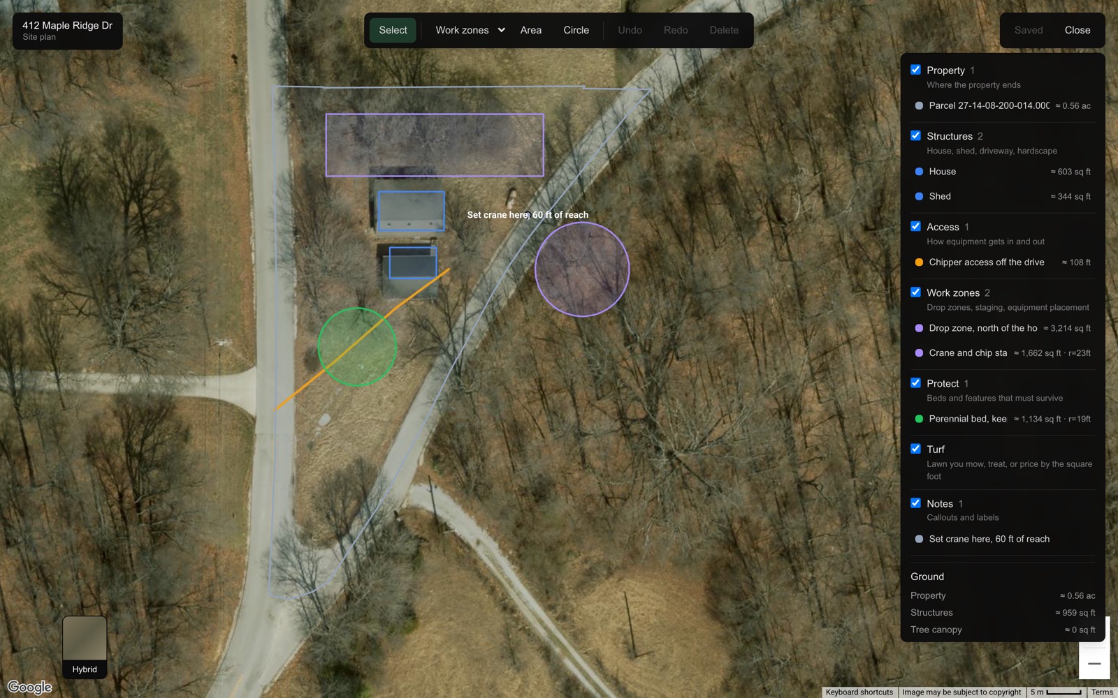
A removal is easier to sell and safer to run when everyone can see the plan. Site plans let you draw the job on the customer's own property: where the wood drops, how the chipper gets in, and which beds have to survive. Where we have county records, the property line is already drawn when you open it.
Start here
Opening a plan
- Open a customer, then open one of their sites.
- Choose Site plan.
- The map opens framed on the property, not on a fixed zoom. If you have drawn here before, your work is on screen straight away.
Everything you draw saves as a numbered revision. If two people have the same plan open, the second one to save is told the plan moved on rather than quietly writing over the first. Nothing you drew is ever thrown away without you choosing it.
The part that saves the most time
The property line draws itself
When you open a plan, we look up the recorded parcel for that address and draw it as a faint dashed outline. You can see exactly where the county says the boundary runs before you decide to use it. On a wooded lot that is often the whole question, because the fence and the record do not always agree.
To adopt it, click Use county parcel as property line at the bottom right. It becomes a normal boundary with draggable corners, the same as if you had traced it, and the recorded acreage comes with it. One undo removes it if you change your mind.
County records, not a survey
A recorded parcel line is an authoritative record of an ownership claim. It is not a boundary survey, it is not stamped, and it can sit several feet off where the fence actually is. We say so on the button before you click it and we store it with the drawing. Use it as a starting point, and move the corners when you can see the real line.
Where this works today
Parcel lookup is live for Indiana right now, and we are adding counties one at a time. Everywhere else, the plan tells you plainly that there are no public records for that county yet and you draw the boundary by hand. Building outlines are not automatic anywhere yet, because no free source of them is good enough to put in front of a customer.
Drawing
What you can mark up
Pick a layer, pick a shape, and click the corners. Each layer only offers the shapes that make sense for it, so an access route is always a line and a property line is always an area.
- Property: where the property ends.
- Structures: house, shed, driveway, hardscape.
- Access: how equipment gets in and out.
- Work zones: drop zones, staging, equipment placement.
- Protect: beds and features that must survive.
- Turf: lawn you mow, treat, or price by the square foot.
- Notes: callouts like "set crane here, 60 ft of reach".
Every shape carries its own measurement. A property reads in acres, because that is how a lot is discussed. Everything you draw on it reads in square feet, however big it gets, because nobody sizes a crane pad in acres.
Turn any layer off to see the rest, undo and redo as much as you like, and click a shape in the list to select it on the map.
Measurement
The ground adds itself up
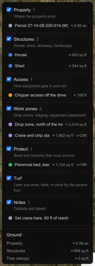
At the bottom of the layer list, the plan keeps a running count of the property: how much is structures, how much is under tree canopy, and how much is open ground. It uses the canopy width your crew recorded on each tree, so the subtraction comes from what someone actually measured on site rather than from a guess at a picture.
Draw a turf area and you get a second figure under it: the same area with the buildings and canopy inside it taken back out. That means you can loop the yard roughly, including straight over the trees, and still get a mowable number. Nobody has to trace around a maple.
It tells you what it could not account for
The panel says how many of the site's trees had a canopy width on file, and it says when you have not traced any structures yet, so you always know how finished the number is. The leftover is called open ground rather than turf on purpose. On a wooded lot most of it is brush and understory, and calling that lawn would price the job wrong.
Views
Four ways to look at it
- Plan: a clean paper background with the streets faint, so the drawing stands on its own.
- Satellite: the most current imagery.
- Ortho: the best available public aerial, which in many places is flown with the leaves off. Far easier to see structure and stems through.
- Hybrid: that same aerial with roads and place names over it.
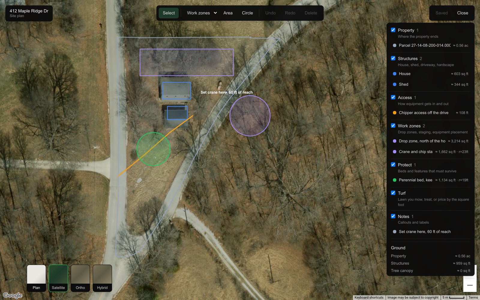
Switch between them at the bottom left. What you draw is the same in every view, so you can trace on the aerial and hand over the clean paper version.
What is next
Coming to this
- The plan on the proposal, so the customer sees the drawing next to the price.
- Fall radius and safe felling sectors worked out from the tree heights your crew captured.
- Turf square footage feeding straight into a line item.
- More counties for automatic property lines.